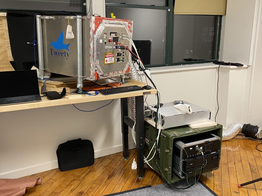
After many months of communications and preparations, a team from 3DEO, with headquarters located in Dover, MA, finally launched a research project in Lawrence, MA near the winter crow roost. The research study is part of a larger study looking at “Precision Tracking of Birds and drones using Fast Efficient 3D Lidar. This project is a result of grant funding from the U.S. Department of Defense under the U.S. Army Corps of Engineers. Here are a few images of the temporary office space set up by staff members and a look at the Lidar scanning machine with a nickname of “TWEETY.” Image below from the temporary office space shows the set up for “Tweety” lidar unit and other gear near the east facing windows with views overlooking the roost along Prospect Hill.

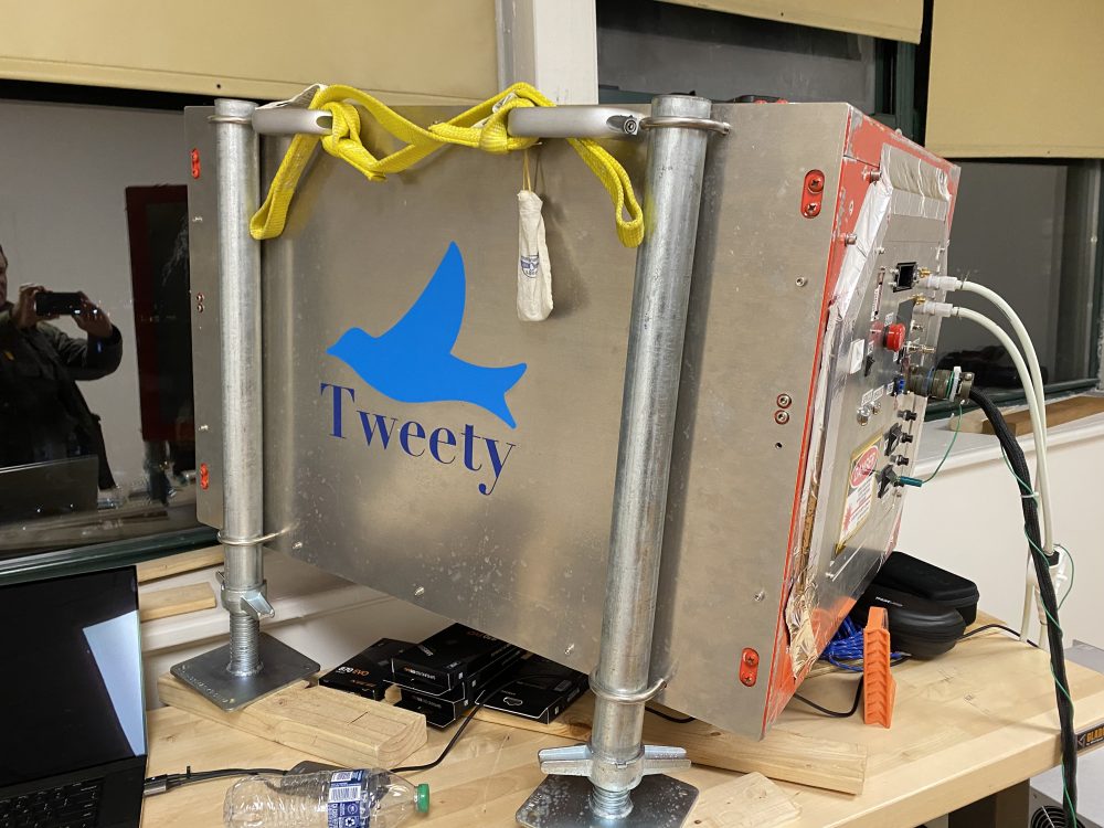
This next image shows “Tweety” the actual LIDAR recording unit with custom mounting framework for the window view! This new lidar technology allows detailed 3D aerial surveying to be done at a fraction of the cost achievable by conventional lidar systems. The technology was developed for military and intelligence applications, and has proven robust and revolutionary in multiple military and non-military applications.

Here is an abstract of the project from 3DEO:
We propose to build and demonstrate a system that will robustly detect and track non-cooperative small airborne objects, initially focusing on large flocks of small birds. Detection is achieved using a rapidly-scanned 3D imaging lidar with single-photon sensitivity, which enables pinpoint geolocation and easily resolves flying objects against clutter such as buildings, ground vehicles, and trees. The 3D lidar directly measures the 4D coordinates (position and time) of the flying objects, providing unambiguous inputs to a tracking algorithm. The tracker develops and propagates the tracks of thousands of flying objects in real time. This project builds from a Phase 1 SBIR study which demonstrated the promise of this approach through simulations. The proposed effort will build a lidar optimized for the given challenge (bird tracking), and a processing system designed to report tracks in real time. The demonstration system will scan a cube of edge length 100 m at a distance 400 m from the lidar at a rate of 10 Hz with angular resolution of approximately 150 microradians. A processing system remote from the bird flock will calculate the tracks. The proposed effort includes two field campaigns where large flocks are expected to be present.
The image below is a screen capture from a actual video using the 3D imaging lidar!

3DEO is a hardware spin-out from MIT Lincoln Lab, commercializing advanced lidar systems for airborne 3D mapping. 3DEO designs, builds, qualifies, operates, and maintains lidar systems for government and commercial applications. Their engineers have designed and built the world’s most capable lidar sensors, integrated them into airplanes, flown with them, and gotten them to work reliably for operational use by the US Department of Defense.
3DEO builds upon Department of Defense investments in Geiger-mode lidar totaling well over $100M spanning more than a decade. We are indebted to the vision, insights, and hard work of a large community of talented people in several government agencies, research and development centers, and corporations. Their customers have included DARPA, USSOUTHCOM, US Army, and MIT Lincoln Laboratory.


Leave A Comment